Finding the area
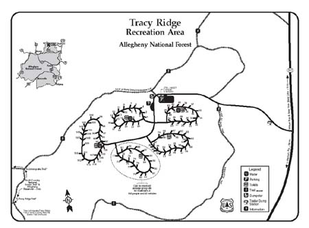
Tracy Ridge Recreation Area is located on State Route 321, north of the junction with SR 59 and south of the junction with SR 346. Tracy Ridge sits on a ridge top three miles east of the Allegheny Reservoir.
GPS Coordinates
N 41 56.682
W 078 52.628
Facilities
Open April 1st to Dec. 14th. The back loop closes the end of October. Reservations are taken Memorial Day through Labor Day.
Handles on water pumps May to October.
There are 45 open spacious, tree-shaded campsites, each containing a picnic table, fire ring, and tent pad. Hand-pumped water and vault toilets are also available. Loops A, B, and E are open. Please note numerous sites are closed to concentrate efforts on higher occupancy sites. Firewood may be obtained from dead and down trees or available from host when on-site.
Camping fees per night
$12.00
Other features
Tracy Ridge Hiking Trails System (marked with off-white blazes) leads to the Reservoir. It also links up with the North Country National Scenic Trail, marked with blue blazes. By using this system in conjunction with the North Country National Scenic Trail, a loop hike of 8.7 miles is possible, beginning and ending at the campground. One feature of these trails is the large, scenic rock formations along their routes.


